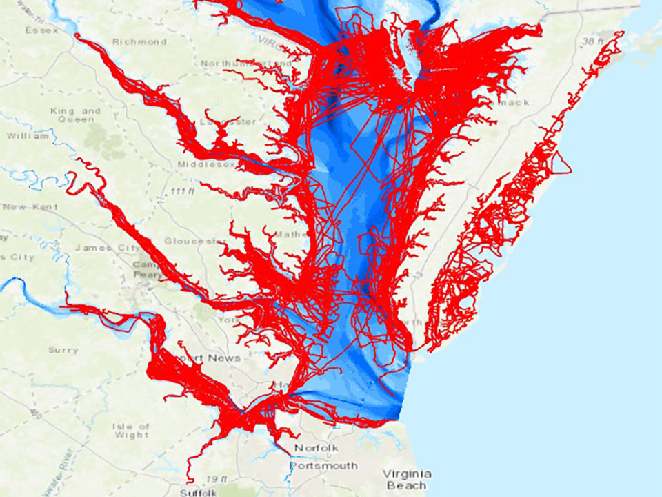
A small operational tweak in a regional fishery is generating a new data dividend for coastal decision-makers — and a case study in how ocean stewardship can pay for itself. NOAA says a partnership with William & Mary’s Virginia Institute of Marine Science (VIMS) and Chesapeake Bay crabbers is turning routine removal of lost and abandoned crab traps into an additional stream of shallow-water bathymetry, the undersea elevation data used in charts and coastal models.
The public-sector logic is straightforward: the same side-scan sonar used to locate derelict gear can also capture seafloor depth points that are otherwise expensive to collect in shallow, complex waters. “By accessing past derelict trap removal depth data and equipping current participants with low-cost sonar units to passively collect bathymetric information, we have generated millions of new bathymetric data points at little to no additional cost,” Kirk Havens, director of VIMS’s Center for Coastal Resources Management, said in a NOAA account of the project.
The cleanup side of the ledger matters on its own. NOAA said abandoned crab traps can continue to catch and kill wildlife, compete with active fishing gear and damage habitats. In other words, even before the mapping benefit is priced in, the removal work is a direct intervention against “ghost fishing” and gear-driven habitat damage.
NOAA framed the mapping challenge in economic terms: despite being the largest estuary in the United States, Chesapeake Bay has relatively scarce shallow-water depth data. The agency said the dataset will be released for public use through NOAA’s National Centers for Environmental Information (NCEI) Bathymetric Data Portal, supporting navigational safety and coastal commerce (NOAA).
For marine policymakers, the implication is that “multiple-benefit” projects — removing debris while producing data — can stretch constrained budgets further. “Accurate, shallow-water bathymetry is the missing puzzle piece for many of our coastal models and navigational charts,” Rear Admiral (lower half) Chris van Westendorp, director of NOAA’s Office of Coast Survey, said (NOAA). He said harnessing commercial mariners’ “presence and expertise” can unlock a new data stream and turn contributions into “actionable knowledge that protects lives and coastal economies.”
NOAA also summarised the approach in a shorter update on its Response & Restoration site, describing how the Nationwide Trap Removal, Assessment, and Prevention (TRAP) program equips commercial crabbers with side-scan sonar to locate abandoned traps, while the same equipment “simultaneously collects valuable mapping data about the seafloor” (NOAA Response & Restoration).
Across the Pacific, multilateral lenders are also leaning into “resilience as infrastructure” — financing designed to keep essential systems working when shocks hit. In a separate announcement this week, the Asian Development Bank said it is updating crisis-response financing tools so they can be deployed faster in response to energy supply and food price shocks (ADB). “Ongoing instability from the Middle East conflict is putting pressure on governments and people across the region, raising fuel bills, food prices, borrowing costs,” ADB President Masato Kanda said, adding that the bank is moving quickly “before shocks become deeper crises” (ADB).
The two initiatives operate at different scales, but they converge on a practical thesis: ocean-dependent economies need cleaner waters, better data and faster-response public finance. That is the spirit OceanVines brings to its work — to illuminate the inner sparks of every life we touch through our efforts in ocean conservation and education.
Sources: NOAA National Ocean Service · NOAA Response & Restoration · Asian Development Bank
Together, we celebrate The Greatest Good.